|
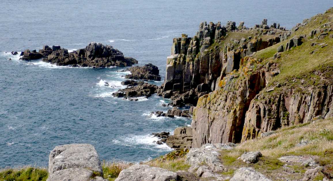
Land's End (Cornish: Penn an Wlas or Pedn an Wlas) is a headland and holiday complex in western Cornwall, England. It is the most westerly point of mainland Cornwall and England, is within the Penwith peninsula and is about eight miles (13 km) west-southwest of Penzance at the starting and finishing point of the A30 road.
Land's End has a particular resonance because it is often used to suggest distance. Land's End to John o' Groats in Scotland is a distance of 838 miles (1,349 km) by road and this Land's End to John o' Groats distance is often used to define charitable events such as end-to-end walks and races in the UK.
There are two varieties of granite represented at Land's End. Adjacent to the hotel the granite is coarse-grained with large phenocrysts of orthoclase, sometimes more than 5 in (13 cm) in length. To the north, at the First and Last House, there is a finer grained granite with fewer and smaller phenocrysts, and the different granites can be seen from a distance by the smoother weathering of the finer variety. The granite dates to 268–275 million years ago of the Permian period. The contact zone between the Land's End granite pluton and the altered ″country rocks″ is nearby and the Longships
Lighthouse, offshore, is built on the country rock. The Longships, a group of rocky islets are just over a 1 mile (1.6 km)
mile offshore, and together with the Seven Stones Reef and the Isles of Scilly which lie approximately 28 miles (45 km) southwest — are part of the mythical lost land of Lyonesse, referred to in Arthurian literature.
The headland has been designated part of an Important Plant Area, by the organisation Plantlife, for rare species of flora.
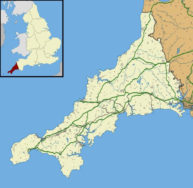
Location
map of Cornwall, with Lands End being the furthermost western tip
PENZANCE
Penzance is a town, civil parish and port in Cornwall, in England,
United
Kingdom. It is well known for being the most westerly major town in Cornwall and is approximately 75 miles (121 km) west of Plymouth and 300 miles (480 km) west-southwest of London. Situated in the shelter of Mount's Bay, the town faces south-east onto the
English
Channel, is bordered to the west by the fishing port of Newlyn, to the north by the civil parish of Madron and to the east by the civil parish of Ludgvan.
CORNWALL
Cornwall is a ceremonial county and unitary authority area of England, within the United Kingdom. Cornwall is a peninsula bordered to the north and west by the Celtic Sea, to the south by the English Channel, and to the east by the county of Devon, over the River Tamar. Cornwall has a population of 536,000 and covers an area of 3,563 km2 (1,376 sq mi). The administrative centre, and only city in Cornwall, is Truro, although the town of St Austell has the largest population.
Cornwall forms the westernmost part of the south-west peninsula of the island of Great Britain, and a large part of the Cornubian batholith is within Cornwall. This area was first inhabited in the Palaeolithic and Mesolithic periods. It continued to be occupied by
Neolithic and then Bronze Age peoples, and later (in the Iron Age) by Brythons with distinctive cultural relations to neighbouring Wales and Brittany. There is little evidence that Roman rule was effective west of Exeter and few Roman remains have been found. Cornwall was the home of a division of the Dumnonii tribe – whose tribal centre was in the modern county of Devon – known as the Cornovii, separated from the Brythons of
Wales after the Battle of Deorham, often coming into conflict with the expanding English kingdom of Wessex before King Athelstan in AD 936 set the boundary between
English and Cornish at the high water mark of the eastern bank of the River Tamar. From the early Middle Ages, British language and culture was apparently shared by Brythons trading across both sides of the Channel, evidenced by the corresponding high medieval Breton kingdoms of Domnonée and Cornouaille and the Celtic
Christianity common to both territories.
Historically tin mining was important in the Cornish economy, becoming increasingly significant during the High Middle Ages and expanding greatly during the 19th century when rich copper mines were also in production. In the mid-19th century, however, the tin and copper mines entered a period of decline. Subsequently china clay extraction became more important and metal mining had virtually ended by the 1990s. Traditionally fishing (particularly of
pilchards), and agriculture (particularly of dairy products and vegetables), were the other important sectors of the economy. The railways led to the growth of tourism during the 20th century, however, Cornwall's economy struggled after the decline of the mining and
fishing industries. The area is noted for its wild moorland landscapes, its long and varied coastline, its attractive villages, its many place-names derived from the Cornish language, and its very mild climate. Extensive stretches of Cornwall's coastline, and Bodmin Moor, are protected as an Area of Outstanding Natural Beauty.
CANNONBALL
JOGLE
A
"Jogle" run is where a person travels from John o'Groats in Scotland,
to Lands End, rather then the more traditional (LEJOG) Lands End to John
o'Groats. An attempt by Team Speedace to beat the EV record set by Tesla
in 2011, is planned for June of 2015, or as soon as possible after that
date in an electric sports car prototype called the Ecostar
DC50. The Cannonball
International series of zero emission vehicle runs is designed to
draw attention to global warming and the need for sustainable transport
policies.
LINKS
and REFERENCE
Wikipedia
Cornwall Visit
Cornwall Wikipedia
Penzance Wikipedia
Lands_End http://en.wikipedia.org/wiki/Cornwall http://www.visitcornwall.com/ http://en.wikipedia.org/wiki/Penzance http://en.wikipedia.org/wiki/Land%27s_End
|
Adelaide
Aden
- Yemen
Afghanistan
Africa
Alaska
Algeria
Amsterdam
Antarctic
- Antarctica
Arctic
- North
Pole
Argentina
Asia
Athens
Australia
Austria
Aztecs
- Mexico
Bahamas
Bangladesh
Baghdad
Bahrain
Barbados
Beachy
Head, England
Belgium
Berlin
Bermuda
Black
Rock Desert, Nevada
Bohemia
Bolivia
Bonneville,
Utah - History
Brazil
Brighton
- West Pier
British
Columbia
Bulgaria
Burma
Canada
Canary
Islands
Cape
Hope
Cape
York - Au
Caribbean
- Central America
Cayman
Islands
Chichester
Harbour
Chile
China
- Beijing
Columbia
- S. America
Columbo
- Sri Lanka
Cowes,
Isle of Wight
Croatia
Cuba
Cyprus
Czechoslovakia
Darwin
- Australia
Daytona
Beach
- Florida USA
Denmark
Dubai
Eastbounre
Pier, England
Earthquakes
Egypt
Equador
Equator
Europe
Falkland
Islands
Falmouth,
Cornwall
Fiji
Finland
Florida
France
Galapagos
Islands
Geography
Links
Geography
Records
Geography
Resources
|
Geography
Statistics
Germany
Gibraltar
- Links
Greece
Greenland
Hampshire
Hawaii
Holland
- Volendam
Hollywood,
California, LA
Hong
Kong
Hungary
Hurricanes
Iceland
India
- Mumbai
Indonesia
Links
Iran
Iraq
Ireland
Isle
of Man
Isle
of Wight
- The
Needles
Israel
Italy
Jakarta
- Java
Jamaica
Japan
Jordan
Kent,
England - Sandgate
Kenya
Korea
Kuwait
Kyoto
- Japan
Las
Vegas -
Lebanon
Libya
Life
on Earth
London
- Big
Ben
London
Eye - Madame
Tussauds
London
Houses
Parliament
London
- Buckingham
Palace
London
- Old
Bailey
London
- Overview
London
- The City
London
- Tower Bridge
London
- Trafalgar
Square
Luxembourg
Malaysia
Malta
Maya
Empire -
Central America
Melbourne,
Australia
Mexico
Middle
East
Monaco
Morocco
Mountains
Naples-
Italy
National
Geographic
Nepal
Nertherlands
- Eindhoven
New
York
New
Zealand
Nigeria
North
Africa
Norway
Nova
Scotia
Oceans
and Seas
Oman
Pakistan
Palermo
- Sicily
Palestine
|
Palma
- Malorca
Panama
Canal - Links
Paris
Pendine
Sands - Carmarthen
Peru
Philippines
Pisa
Planet
Earth
Poland
Port
Moresby - PNG
Port
Said - Egypt
Portugal
Puerto
Rico
Qatar
Quebec
Rio
de Janeiro
Romania
Rome
Russia
Salt
Lake City - Utah
Saudi
Arabia
Scotland
Senegal
West Africa
Singapore
Somalia
South
Africa
South
America
Southampton
Spain
- Espana
Sri
Lanka - Links
Stonehenge
Suez
Canal
Sudan
Surrey,
England Index
Sussex,
England Index
Sweden
Switzerland
Sydney,
Australia
Syria
Tahiti
- Polynesia
- Links
Taiwan
Thailand
Tokyo,
Japan
Tonga
- Polynesia
Toronto
Trinidad
- Lesser Antilles
Tsunami
Tunbridge
Wells, England
Tunisia
Turkey
UAE
- United Arab Emirates
UK
Statistics
Ukraine
United
Kingdom
United
Kingdom -
Gov
USA
Venezuela
Venice
Vienna
Vietnam
Volcanoes
Wales
Washington
D.C.
Wealden
iron industry
Wendover,
Utah
World
Peace Supporters
Yemen
Yugoslavia
Zurich
|
Solar
Cola drinkers care about climate chaos
...
..
Thirst for Life

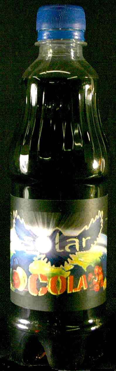
330ml
Planet Earth can and 500ml bottle
|