|
Wind is the flow of air. More generally, it is the flow of the gases which compose an atmosphere; since wind is not unique to
Earth. Simply it occurs as air is heated by the sun and thus rises. Cool air then rushes in to occupy the area from which the hot air has now moved. It could be loosely classed as a convection current.
Winds are commonly classified by their spatial scale, their speed, the types of forces that cause them, the geographic regions in which they occur, or their effect.
There are global winds, such as the wind belts which exist between the atmospheric circulation cells. There are upper-level winds which typically include narrow belts of concentrated flow called jet streams. There are synoptic-scale winds that result from pressure differences in surface air masses in the middle latitudes, and there are winds that come about as a consequence of geographic features, such as the sea breezes on coastlines or canyon breezes near mountains. Mesoscale winds are those which act on a local scale, such as gust fronts. At the smallest scale are the
micro-scale winds, which blow on a scale of only tens to hundreds of meters and are essentially unpredictable, such as dust devils and
micro-bursts.
Forces which drive wind or affect it are the pressure gradient force, the Coriolis force, buoyancy forces, and friction forces. When a difference in pressure exists between two adjacent air masses, the air tends to flow from the region of high pressure to the region of low pressure. On a rotating planet, flows will be acted upon by the Coriolis force, in regions sufficiently far from the equator and sufficiently high above the surface.
The three major driving factors of large scale global winds are the differential heating between the equator and the poles (difference in absorption of solar energy between these climate zones), and the rotation of the planet.
Winds can shape landforms, via a variety of eolian processes.
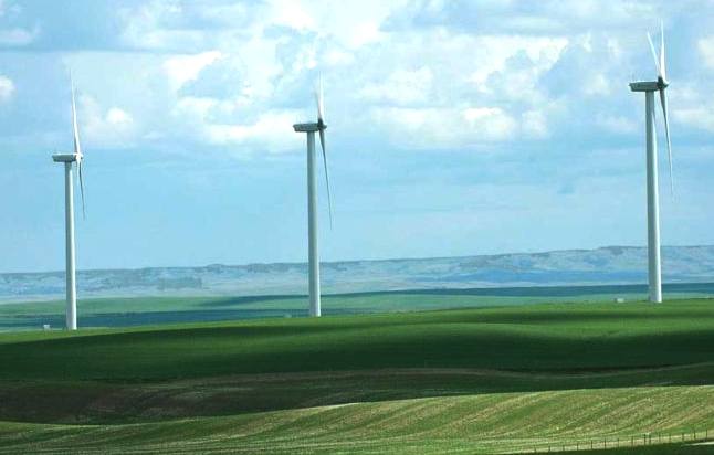
Wind
farm at Magrath, Alberta, Canada
Local winds that are tied to specific temperature distributions
Some local winds blow only under certain circumstances, i.e. they require a certain temperature distribution.
Differential heating is the motive force behind land breezes and sea breezes (or, in the case of larger lakes, lake breezes), also known as on- or off-shore winds. Land absorbs and radiates heat faster than water, but water releases heat over a longer period of time. The result is that, in locations where sea and land meet, heat absorbed over the day will be radiated more quickly by the land at night, cooling the air. Over the sea, heat is still being released into the air at night, which rises. This convective motion draws the cool land air in to replace the rising air, resulting in a land breeze in the late night and early morning. During the day, the roles are reversed. Warm air over the land rises, pulling cool air in from the sea to replace it, giving a sea breeze during the afternoon and evening.
Mountain breezes and valley breezes are due to a combination of differential heating and geometry. When the sun rises, it is the tops of the mountain peaks which receive first light, and as the day progresses, the mountain slopes take on a greater heat load than the valleys. This results in a temperature inequity between the two, and as warm air rises off the slopes, cool air moves up out of the valleys to replace it. This upslope wind is called a valley breeze. The opposite effect takes place in the afternoon, as the valley radiates heat. The peaks, long since cooled[vague], transport air into the valley in a process that is partly gravitational and partly convective and is called a mountain breeze.
Forested areas are less windy than plains and cities because the tree's disrupt wind patterns. Tree's are thus considered to have a dampening effect on wind speeds in that they reduce the partial derivative of pressure differences across non-infinitively occupying plain. Further effects of tree's wind reducing capabilities is in the fact that trees bend in the wind. Considering the mass of a tree in comparison to air particles it is highly predicable that much of the total energy of the wind is lost in kinetic energy to the trees.
Mountain breezes are one example of what is known more generally as a katabatic wind. These are winds driven by cold air flowing down a slope, and occur on the largest scale in Greenland and Antarctica. Most often, this term refers to winds which form when air which has cooled over a high, cold plateau is set in motion and descends under the influence of gravity. Winds of this type are common in regions of Mongolia and in glaciated locations.
Because katabatic refers specifically to the vertical motion of the wind, this group also includes winds which form on the lee side of mountains, and heat as a consequence of compression. Such winds may undergo a temperature increase of 20 °C (68 °F) or more, and many of the world's "named" winds (see list below) belong to this group. Among the most well-known of these winds are the chinook of Western Canada and the American Northwest, the Swiss föhn, California's infamous Santa Ana wind, and the French Mistral.
The opposite of a katabatic wind is an anabatic wind, or an upward-moving wind. The above-described valley breeze is an anabatic wind.
A widely-used term, though one not formally recognised by meteorologists, is orographic wind. This refers to air which undergoes orographic lifting. Most often, this is in the context of winds such as the chinook or the föhn, which undergo lifting by mountain ranges before descending and warming on the lee side.
Winds that are defined by an equilibrium of physical forces
These winds are used in the decomposition and analysis of wind profiles. They are useful for simplifying the atmospheric equations of motion and for making qualitative arguments about the horizontal and vertical distribution of winds. Examples are:
Geostrophic wind (wind that is a result of the balance between Coriolis force and pressure gradient force; flows parallel to isobars and approximates the flow above the atmospheric boundary layer in the midlatitudes if frictional effects are low)
Thermal wind (not actually a wind but a wind difference between two levels; only exists in an atmosphere with horizontal temperature gradients, i.e. baroclinicity)
Ageostropic wind (difference between actual and geostrophic wind; the wind component which is responsible for air "filling up" cyclones over time)
Gradient wind (like geostrophic wind but also including centrifugal force)
Names for specific winds in certain regions
In ancient Greek mythology, the four winds were personified as gods, called the Anemoi. These included Boreas, Notos, Euros, and Zephyros. The Ancient Greeks also observed the seasonal change of the winds, as evidenced by the Tower of the Winds in Athens.
In modern usage, many local wind systems have their own names.
Meteorological instruments to measure wind speed and/or direction
Wind direction is reported by the direction from which it originates. For example, a northerly wind blows from the north to the south.
Local sensing techniques
-
Anemometer (measures wind speed, either directly, e.g. with rotating cups, or indirectly, e.g. via pressure differences or the propagation speed of ultrasound signals)
-
Rawinsonde (GPS-based wind measurement is performed by the probe)
-
Weather balloon (passive measurement, balloon position is tracked from the ground visually or via radar; wind profile is computed from drift rate and the theoretical speed of ascent)
-
Weather vane (used to indicate wind direction)
-
Windsock (primarily used to indicate wind direction, may also be used to estimate wind speed by its angle)
-
Pitot tubes
Remote sensing techniques:
-
SODAR
-
Doppler LIDARs can measure the Doppler shift of light reflected off suspended aerosols or molecules. This measurement can be directly related to wind velocity.
-
Radiometers and Radars can be used to measure the surface roughness of the ocean from space or airplanes. This measurement can be used to estimate wind velocity close to the sea surface over oceans.
LINKS
and REFERENCE
WINDMILL
TURBINE 1
TURBINE 2

..
Thirst for Life

330ml
Earth can - the World in Your Hands
|