Coastal
types around Antarctica (Drewry, 1983)
|
Type
|
Frequency
|
|
Ice
shelf (floating ice front)
|
44%
|
|
Ice
walls (resting on ground)
|
38%
|
|
Ice
stream/outlet glacier (ice front or ice wall)
|
13%
|
|
Rock
|
5%
|
|
Total
|
100%
|
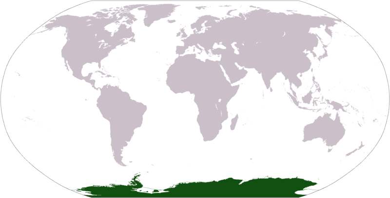
Physically,
it is divided in two by the Transantarctic Mountains close to the neck
between the Ross Sea and the Weddell Sea. The portion west of the Weddell
Sea and east of the Ross Sea is called Western Antarctica and the
remainder Eastern Antarctica, because they roughly correspond to the
Western and Eastern Hemispheres relative to the Greenwich
meridian.
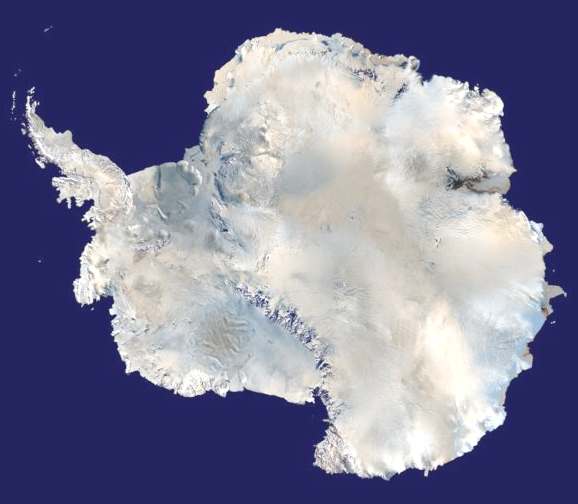
About
98% of Antarctica is covered by the Antarctic ice sheet. The ice sheet is,
on average, 2.5 kilometers (1.6 miles) thick. The continent has
approximately 90% of the world's fresh water,
in the form of ice. In most of the interior of the continent precipitation
is very low, down to 20 mm/yr; in a few "blue ice" areas
precipitation is lower than mass loss by sublimation and so the local mass
balance is negative. In the dry valleys the same effect occurs over a rock
base, leading to a desiccated landscape.
Western
Antarctica is covered by the West Antarctic Ice Sheet. The sheet has been
of recent concern because of the real, if small, possibility of its
collapse. If the sheet were to break down, ocean levels would rise by
several meters in a relatively geologically short period of time, perhaps
a matter of centuries. Several Antarctic ice streams, which account for
about 10% of the ice sheet, flow to one of the many Antarctic ice shelves.
Vinson
Massif, the highest peak in Antarctica at 4892 meters (16,050 feet),
is located in the Ellsworth Mountains. Although Antarctica is home to many
volcanoes, only Mt. Erebus is active. Mount Erebus, located in Ross
Island, is the southernmost active volcano. There was another famous
volcano called Deception Island, which is famous for its giant eruption in
1970. Minor eruptions are frequent and lava flow has been observed in
recent years. Other dormant volcanoes may potentially be active. In 2004,
an underwater volcano was found in the Antarctic Peninsula by American and
Canadian researchers. Recent evidence shows this unnamed volcano may be
active.
Antarctica
is home to more than 70 lakes that lie thousands of meters under the
surface of the continental ice sheet. Lake Vostok, discovered beneath
Russia's Vostok Station in 1996, is the largest of these subglacial lakes.
It is believed that the lake has been sealed off for 35 million years.
There is some evidence that Vostok's waters may contain microbial life.
The sealed, frozen surface of the lake shares similarities with Jupiter's
moon Europa. Confirming that life can survive in Lake Vostok strengthens
the argument for life on the satellite.
Antarctica
is the stage for another John Storm adventure when
scientists
find
the remains of a prehistoric animal that may have caused
the extinction
of
the dinosaurs
FACTS
- Antarctica Geological history and paleontology
More than 170 million years ago, Antarctica was part of
the supercontinent Gondwana. Over time, Gondwana
gradually broke apart and Antarctica as we know it today
was formed around 25 million years ago. Antarctica was
not always cold, dry and covered in ice sheets. At a
number of points in its long history it was farther
north, experienced a tropical or temperate climate, was
covered in forests, and inhabited by various ancient
life-forms.
Paleozoic era (540–250 Ma)
During the Cambrian period, Gondwana had a mild climate.
West Antarctica was partially in the Northern
Hemisphere, and during this period large amounts of
sandstones, limestones and shales were deposited. East
Antarctica was at the equator, where sea floor
invertebrates and trilobites flourished in the tropical
seas. By the start of the Devonian period (416 Ma),
Gondwana was in more southern latitudes and the climate
was cooler, though fossils of land plants are known from
this time. Sand and silts were laid down in what is now
the Ellsworth, Horlick and Pensacola Mountains.
Glaciation began at the end of the Devonian period (360
Ma), as Gondwana became centered around the South Pole
and the climate cooled, though flora remained. During
the Permian period, the plant life became dominated by
fern-like plants such as Glossopteris, which grew in
swamps. Over time these swamps became deposits of coal
in the Transantarctic Mountains. Towards the end of the
Permian period, continued warming led to a dry, hot
climate over much of Gondwana.
Mesozoic era (250–65 Ma)
As a result of continued warming, the polar ice caps
melted and much of Gondwana became a desert. In Eastern
Antarctica, the seed fern became established, and large
amounts of sandstone and shale were laid down at this
time. Synapsids, commonly known as "mammal-like
reptiles", were common in Antarctica during the
Late Permian and Early Triassic and included forms such
as Lystrosaurus. The Antarctic Peninsula began to form
during the Jurassic period (206–146 Ma), and islands
gradually rose out of the ocean. Ginkgo trees and cycads
were plentiful during this period. In West Antarctica,
coniferous forests dominated through the entire
Cretaceous period (146–65 Ma), though Southern beech
began to take over at the end of this period. Ammonites
were common in the seas around Antarctica, and dinosaurs
were also present, though only three Antarctic dinosaur
genera (Cryolophosaurus and Glacialisaurus, from the
Hanson Formation, and Antarctopelta) have been described
to date. It was during this period that Gondwana began
to break up.
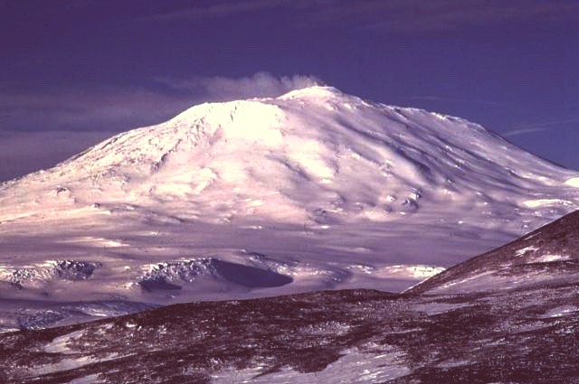
Mount
erebus, an active volcano in Antarctica
Gondwanaland breakup (160–23 Ma)
The cooling of Antarctica occurred stepwise, as the
continental spread changed the oceanic currents from
longitudinal equator-to-pole temperature-equalizing
currents to latitudinal currents that preserved and
accentuated latitude temperature differences.
Africa separated from Antarctica around 160 Ma, followed
by the Indian subcontinent, in the early Cretaceous
(about 125 Ma). About 65 Ma, Antarctica (then connected
to Australia) still had a tropical to subtropical
climate, complete with a marsupial fauna. About 40 Ma
Australia-New Guinea separated from Antarctica, so that
latitudinal currents could isolate Antarctica from
Australia, and the first ice began to appear. During the
Eocene-Oligocene extinction event about 34 million years
ago, CO2 levels have been found to be about 760 ppm and
had been decreasing from earlier levels in the thousands
of ppm. Around 23 Ma, the Drake Passage opened between
Antarctica and South America, resulting in the Antarctic
Circumpolar Current that completely isolated the
continent. Models of the changes suggest that declining
CO2 levels became more important. The ice began to
spread, replacing the forests that then covered the
continent. Since about 15 Ma, the continent has been
mostly covered with ice, with the Antarctic ice cap
reaching its present extension around 6 Ma.
Neogene Period (23–0.05 mya)
In 1986, Peter Webb and a team of paleontologists at
Ohio State University discovered the remains of an
extensive temperate forest that flourished 640
kilometres (400 mi) from the South Pole 3 million years
ago.
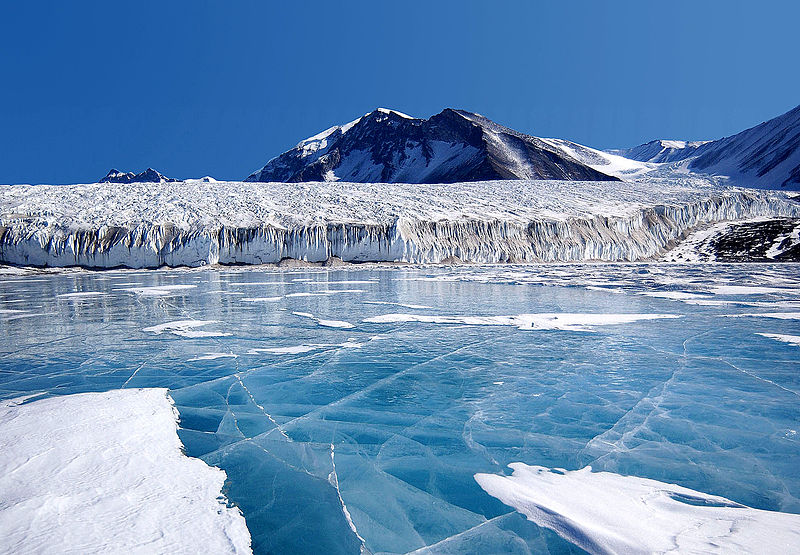
Blue
ice at Lake Tryxell, tranantactic mountains
History of exploration
- Antarctic expeditions
An iceberg dwarfs a ship in this 1920s English magazine illustration of a whaler in the Antarctic.
Belief in the existence of a Terra Australis – a vast continent in the far south of the globe to "balance" the northern lands of Europe, Asia and North Africa – has existed since the times of Ptolemy (1st century AD), who suggested the idea to preserve the symmetry of all known landmasses in the world. Even in the late 17th century, after explorers had found that South America and Australia were not part of the fabled "Antarctica", geographers believed that the continent was much larger than its actual size.
European maps continued to show this hypothetical land until Captain James Cook's ships, HMS Resolution and Adventure, crossed the Antarctic Circle on 17 January 1773, in December 1773 and again in January
1774. Cook came within about 75 miles (121 km) of the Antarctic coast before retreating in the face of field ice in January
1773. The first confirmed sighting of Antarctica can be narrowed down to the crews of ships captained by three individuals. According to various organizations (the National Science
Foundation, NASA, the University of California, San
Diego, and other sources), ships captained by three men sighted Antarctica in 1820: Fabian Gottlieb von Bellingshausen (an Estonian-born captain in the Imperial Russian Navy), Edward Bransfield (an Irish-born captain in the Royal Navy), and Nathaniel Palmer (an American sealer out of Stonington, Connecticut). Von Bellingshausen saw Antarctica on 27 January 1820, three days before Bransfield sighted land, and ten months before Palmer did so in November 1820. On that day the expedition led by Von Bellingshausen and Mikhail Lazarev on ships Vostok and Mirny reached a point within 32 km (20 mi) of the Antarctic mainland and saw ice fields there. The first documented landing on mainland Antarctica was by the American sealer John Davis in West Antarctica on 7 February 1821, although some historians dispute this
claim.
On 22 January 1840, two days after the discovery of the coast west of the Balleny Islands, some members of the crew of the 1837-40 expedition of Jules Dumont d'Urville disembarked on the highest
islet of a group of rocky islands about 4 km from Cape Geodesie on the coast of Adélie land where they took some mineral, algae and animal
samples.
In December 1839, as part of the United States Exploring Expedition of 1838–42 conducted by the United States Navy (sometimes called the "Ex. Ex.", or "the Wilkes Expedition"), an expedition sailed from Sydney, Australia, into the Antarctic Ocean, as it was then known, and reported the discovery "of an Antarctic continent west of the Balleny Islands" on 25 January 1840. That part of Antarctica was later named "Wilkes Land", a name it maintains to this day.
Explorer James Clark Ross passed through what is now known as the Ross Sea and discovered Ross Island (both of which were named for him) in 1841. He sailed along a huge wall of ice that was later named the Ross Ice Shelf. Mount Erebus and Mount Terror are named after two ships from his expedition: HMS Erebus and
Terror. Mercator Cooper landed in East Antarctica on 26 January
1853.
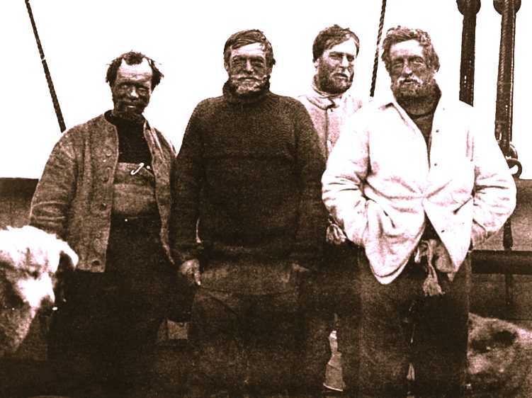
During the Nimrod Expedition led by Ernest Shackleton in 1907, parties led by Edgeworth David became the first to climb Mount Erebus and to reach the South Magnetic Pole. Douglas Mawson, who assumed the leadership of the
Magnetic Pole party on their perilous return, went on to lead several expeditions until retiring in
1931. In addition, Shackleton himself and three other members of his expedition made several firsts in December 1908 – February 1909: they were the first humans to traverse the Ross Ice Shelf, the first to traverse the Transantarctic Mountain Range (via the Beardmore Glacier), and the first to set foot on the South Polar Plateau. An expedition led by Norwegian polar explorer Roald
Amundsen from the ship Fram became the first to reach the geographic South Pole on 14 December 1911, using a route from the Bay of
Whales and up the Axel Heiberg
Glacier. One month later, the doomed Scott Expedition reached the pole.
Richard E. Byrd led several voyages to the Antarctic by plane in the 1930s and 1940s. He is credited with implementing mechanized land transport on the continent and conducting extensive geological and biological
research. However, it was not until 31 October 1956 that anyone set foot on the South Pole again; on that day a U.S. Navy group led by Rear Admiral George J. Dufek successfully landed an aircraft
there.
The first person to sail single-handed to Antarctica was the New Zealander David Henry Lewis, in a 10-meter steel sloop Ice Bird.
Climate of Antarctica
Antarctica is the coldest of Earth's continents. The coldest natural temperature ever recorded on Earth was −89.2 °C (−128.6 °F) at the Russian Vostok Station in Antarctica on 21 July 1983.[40] For comparison, this is 11 °C (20 °F) colder than subliming dry ice. Antarctica is a frozen desert with little precipitation; the South Pole itself receives less than 10 cm (4 in) per year, on average.
Temperatures reach a minimum of between −80 °C (−112 °F) and −90 °C (−130 °F) in the interior in winter and reach a maximum of between 5 °C (41 °F) and 15 °C (59 °F) near the coast in summer. Sunburn is often a health issue as the snow surface reflects almost all of the ultraviolet light falling on
it.
The snow surface at Dome C Station is typical of most of the continent's surface.
East Antarctica is colder than its western counterpart because of its higher elevation. Weather fronts rarely penetrate far into the continent, leaving the center cold and dry. Despite the lack of precipitation over the central portion of the continent, ice there lasts for extended time periods. Heavy snowfalls are not uncommon on the coastal portion of the continent, where snowfalls of up to 1.22 metres (48 in) in 48 hours have been recorded.
At the edge of the continent, strong katabatic winds off the polar plateau often blow at storm force. In the interior, however, wind speeds are typically moderate. During summer, more solar radiation reaches the surface during clear days at the South Pole than at the equator because of the 24 hours of sunlight each day at the
Pole.
Antarctica is colder than the Arctic for two reasons. First, much of the continent is more than 3 kilometres (2 mi) above sea level, and temperature decreases with elevation. Second, the Arctic Ocean covers the north polar zone: the ocean's relative warmth is transferred through the icepack and prevents temperatures in the Arctic regions from reaching the extremes typical of the land surface of Antarctica. Given the latitude, long periods of constant darkness or constant sunlight create climates unfamiliar to human beings in much of the rest of the
world.
The aurora australis, commonly known as the southern lights, is a glow observed in the night sky near the South Pole created by the plasma-full solar winds that pass by the Earth. Another unique spectacle is diamond dust, a ground-level cloud composed of tiny ice crystals. It generally forms under otherwise clear or nearly clear skies, so people sometimes also refer to it as clear-sky precipitation. A sun dog, a frequent atmospheric optical phenomenon, is a bright "spot" beside the true
sun.
Population - Demographics of Antarctica and Research stations of Antarctica
The "ceremonial" South Pole, at Amundsen-Scott Station
A number of governments maintain permanent manned research stations throughout the continent. The number of people conducting and supporting scientific research and other work on the continent and its nearby islands varies from about 1,000 in winter to about 5,000 in the summer. Many of the stations are staffed year-round, the winter-over personnel typically arriving from their home countries for a one-year assignment. An Orthodox church, Trinity Church, opened in 2004 at the Russian Bellingshausen Station is also manned year-round by one or two priests, who are similarly rotated every
year.
The first semi-permanent inhabitants of regions near Antarctica (areas situated south of the Antarctic Convergence) were British and American sealers who used to spend a year or more on South Georgia, from 1786 onward. During the whaling era, which lasted until 1966, the population of that island varied from over 1,000 in the summer (over 2,000 in some years) to some 200 in the winter. Most of the whalers were Norwegian, with an increasing proportion of Britons. The settlements included Grytviken, Leith Harbour, King Edward Point, Stromness, Husvik, Prince Olav Harbour, Ocean Harbour and Godthul. Managers and other senior officers of the whaling stations often lived together with their families. Among them was the founder of Grytviken, Captain Carl Anton Larsen, a prominent Norwegian whaler and explorer who, along with his family, adopted British citizenship in 1910.
The first child born in the southern polar region was Norwegian girl Solveig Gunbjørg Jacobsen, born in Grytviken on 8 October 1913, and her birth was registered by the resident British Magistrate of South Georgia. She was a daughter of Fridthjof Jacobsen, the assistant manager of the whaling station, and of Klara Olette Jacobsen. Jacobsen arrived on the island in 1904 and became the manager of Grytviken, serving from 1914 to 1921; two of his children were born on the
island.
Emilio Marcos Palma was the first person born south of the 60th parallel south (the continental limit according to the Antarctic
Treaty), as well as the first one born on the Antarctic mainland, in 1978 at Base Esperanza, on the tip of the Antarctic
Peninsula; his parents were sent there along with seven other families by the Argentine government to determine if family life was suitable on the continent. In 1984, Juan Pablo Camacho was born at the Frei Montalva Station, becoming the first Chilean born in Antarctica. Several bases are now home to families with children attending schools at the
station. As of 2009, eleven children were born in Antarctica (south of the 60th parallel south): eight at the Argentinean Esperanza
Base and three at the Chilean Frei Montalva Station.
Biodiversity
- Antarctic ecozone and Antarctic microorganism
Emperor Penguins in Ross Sea, Antarctica
Few terrestrial vertebrates live in Antarctica. Invertebrate life includes microscopic mites like the Alaskozetes antarcticus, lice, nematodes, tardigrades, rotifers, krill and springtails. The flightless midge Belgica antarctica, up to 6 millimetres (0.2 in) in size, is the largest purely terrestrial animal in
Antarctica. The Snow Petrel is one of only three birds that breed exclusively in
Antarctica.
A variety of marine animals exist and rely, directly or indirectly, on the phytoplankton. Antarctic sea life includes penguins, blue whales, orcas, colossal squids and fur seals. The Emperor penguin is the only penguin that breeds during the winter in Antarctica, while the Adélie Penguin breeds farther south than any other penguin. The Rockhopper penguin has distinctive feathers around the eyes, giving the appearance of elaborate eyelashes. King penguins, Chinstrap penguins, and Gentoo Penguins also breed in the Antarctic.
The Antarctic fur seal was very heavily hunted in the 18th and 19th centuries for its pelt by sealers from the United States and the United Kingdom. The Weddell Seal, a "true seal", is named after Sir James Weddell, commander of British sealing expeditions in the Weddell Sea. Antarctic krill, which congregates in large schools, is the keystone species of the ecosystem of the Southern Ocean, and is an important food organism for whales, seals, leopard seals, fur seals, squid, icefish, penguins, albatrosses and many other
birds.
A census of sea life carried out during the International Polar Year and which involved some 500 researchers was released in 2010. The research is part of the global Census of Marine Life (CoML) and has disclosed some remarkable findings. More than 235 marine organisms live in both polar regions, having bridged the gap of 12,000 km (7,456 mi). Large animals such as some cetaceans and birds make the round trip annually. More surprising are small forms of life such as mudworms, sea cucumbers and free-swimming snails found in both polar oceans. Various factors may aid in their distribution – fairly uniform temperatures of the deep ocean at the poles and the equator which differ by no more than 5 °C, and the major current systems or marine conveyor belt which transport egg and larvae
stages.
About 400 species of lichen-forming fungi are known to exist in Antarctica.
The climate of Antarctica does not allow extensive vegetation. A combination of freezing temperatures, poor soil quality, lack of moisture, and lack of sunlight inhibit plant growth. As a result, the diversity of plant life is very small and limited in distribution. Excluding organisms which are not plants (algae and fungi, including lichen-forming species), the flora of the continent largely consists of bryophytes (there are about 100 species of mosses and 25 species of liverworts), with only two species of flowering plants, both found in the Antarctic Peninsula: Deschampsia antarctica (Antarctic hair grass) and Colobanthus quitensis (Antarctic pearlwort). Growth generally occurs in the summer, and only for a few weeks at
most.
About 1150 species of fungi have been recorded from Antarctica, of which about 750 are non-lichen-forming and 400 are
lichen-forming. Some of these species are cryptoendoliths as a result of evolution under extreme
conditions. Seven hundred species of algae exist, most of which are phytoplankton. Multicolored snow algae and diatoms are especially abundant in the coastal regions during the
summer. Recently ancient ecosystems consisting of several types of bacteria have been found living trapped deep beneath
glaciers. The autotrophic community is made up of mostly
protists.
Conservation
The dumping of waste (even old vehicles), such as here at the Russian Bellingshausen Station in 1992, is prohibited since the entry into force of the Protocol on Environmental Protection in 1998.
The Protocol on Environmental Protection to the Antarctic Treaty (also known as the Environmental Protocol or Madrid Protocol) came into force in 1998, and is the main instrument concerned with conservation and management of biodiversity in Antarctica. The Antarctic Treaty Consultative Meeting is advised on environmental and conservation issues in Antarctica by the Committee for Environmental Protection. A major concern within this committee is the risk to Antarctica from unintentional introduction of non-native species from outside the
region.
The passing of the Antarctic Conservation Act (1978) in the U.S. brought several restrictions to U.S. activity on Antarctica. The introduction of alien plants or animals can bring a criminal penalty, as can the extraction of any indigenous species. The overfishing of krill, which plays a large role in the Antarctic ecosystem, led officials to enact regulations on fishing. The Convention for the Conservation of Antarctic Marine Living Resources (CCAMLR), a treaty that came into force in 1980, requires that regulations managing all Southern Ocean fisheries consider potential effects on the entire Antarctic
ecosystem. Despite these new acts, unregulated and illegal fishing, particularly of Patagonian toothfish (marketed as Chilean Sea Bass in the U.S.), remains a serious problem. The illegal fishing of toothfish has been increasing, with estimates of 32,000 tonnes (35,300 short tons) in
2000.
Politics
Emblem of the Antarctic Treaty since 2002.
Antarctica has no government, although various countries claim sovereignty in certain regions. While a few of these countries have mutually recognised each other's
claims, the validity of these claims is generally not recognised
universally.
New claims on Antarctica have been suspended since 1959 and the continent is considered politically neutral. Its status is regulated by the 1959 Antarctic Treaty and other related agreements, collectively called the Antarctic Treaty System. Antarctica is defined as all land and ice shelves south of 60° S for the purposes of the Treaty System. The treaty was signed by twelve countries including the Soviet Union (and later Russia), the United Kingdom, Argentina, Chile, Australia, and the United
States. It set aside Antarctica as a scientific preserve, established freedom of scientific investigation and environmental protection, and banned military activity on the continent. This was the first arms control agreement established during the Cold War.
In 1983, the Antarctic Treaty Parties began negotiations on a convention to regulate mining in
Antarctica. A coalition of international organisations launched a public pressure campaign to prevent any minerals development in the region, led largely by Greenpeace
International which established its own scientific station–World Park Base–in the Ross Sea
region and conducted annual expeditions to document environmental effects of humans on the
continent. In 1988, the Convention on the Regulation of Antarctic Mineral Resources (CRAMRA) was
adopted. The following year, however, Australia and France announced that they would not ratify the convention, rendering it dead for all intents and purposes. They proposed instead that a comprehensive regime to protect the Antarctic environment be negotiated in its
place. The Protocol on Environmental Protection to the Antarctic Treaty (the ‘Madrid Protocol’) was negotiated as other countries followed suit and on 14 January 1998 it entered into
force. The Madrid Protocol bans all mining in Antarctica, designating the continent as a ‘natural reserve devoted to peace and science’.
HMS Endurance: the Royal Navy's Antarctic patrol ship
The Antarctic Treaty prohibits any military activity in Antarctica, including the establishment of military bases and fortifications, military manoeuvers, and weapons testing. Military personnel or equipment are permitted only for scientific research or other peaceful
purposes. The only documented military land manoeuvre was Operation NINETY by the Argentine
military.
The United States military issues the Antarctica Service Medal to military members or civilians who perform research duty in Antarctica. The medal includes a "wintered over" bar issued to those who remain on the continent for 2 six-month
seasons.
Economy of Antarctica
The illegal capture and sale of the Patagonian toothfish has led to several arrests. Pictured here is the Antarctic toothfish, a sister species.
Although coal, hydrocarbons, iron ore, platinum, copper, chromium, nickel, gold and other minerals have been found, they have not been in large enough quantities to exploit. The 1991 Protocol on Environmental Protection to the Antarctic Treaty also restricts a struggle for resources. In 1998, a compromise agreement was reached to place an indefinite ban on mining, to be reviewed in 2048, further limiting economic development and exploitation. The primary economic activity is the capture and offshore trading of fish. Antarctic fisheries in 2000–01 reported landing 112,934
tonnes.
Small-scale "expedition tourism" has existed since 1957 and is currently subject to Antarctic Treaty and Environmental Protocol provisions, but in effect self-regulated by the International Association of Antarctica Tour Operators (IAATO). Not all vessels associated with Antarctic tourism are members of IAATO, but IAATO members account for 95% of the tourist activity. Travel is largely by small or medium ship, focusing on specific scenic locations with accessible concentrations of iconic wildlife. A total of 37,506 tourists visited during the 2006–07 Austral summer with nearly all of them coming from commercial ships. The number is predicted to increase to over 80,000 by
2010.
There has been some concern over the potential adverse environmental and ecosystem effects caused by the influx of visitors. A call for stricter regulations for ships and a tourism quota has been made by some environmentalists and
scientists. The primary response by Antarctic Treaty Parties has been to develop, through their Committee for Environmental Protection and in partnership with IAATO, "site use guidelines" setting landing limits and closed or restricted zones on the more frequently visited sites. Antarctic sight seeing flights (which did not land) operated out of Australia and New Zealand until the fatal crash of Air New Zealand Flight 901 in 1979 on Mount Erebus, which killed all 257 aboard. Qantas resumed commercial overflights to Antarctica from Australia in the mid-1990s.
Research
A full moon and 25-second exposure allowed sufficient light for this photo to be taken at Amundsen-Scott South Pole Station during the long Antarctic night. The station can be seen at far left, the power plant in the center and the mechanic's garage in the lower right. The green light in the background is the Aurora
Australis.
Each year, scientists from 28 different nations conduct experiments not reproducible in any other place in the world. In the summer more than 4,000 scientists operate research stations; this number decreases to just over 1,000 in the
winter. McMurdo Station, which is the largest research station in Antarctica, is capable of housing more than 1,000 scientists, visitors, and tourists.
Researchers include biologists, geologists, oceanographers, physicists, astronomers, glaciologists, and meteorologists. Geologists tend to study plate tectonics, meteorites from outer space, and resources from the breakup of the supercontinent Gondwana. Glaciologists in Antarctica are concerned with the study of the history and dynamics of floating ice, seasonal snow, glaciers, and ice sheets. Biologists, in addition to examining the wildlife, are interested in how harsh temperatures and the presence of people affect adaptation and survival strategies in a wide variety of organisms. Medical physicians have made discoveries concerning the spreading of viruses and the body's response to extreme seasonal temperatures. Astrophysicists at Amundsen-Scott South Pole Station study the celestial dome and cosmic microwave background radiation. Many astronomical observations are better made from the interior of Antarctica than from most surface locations because of the high elevation, which results in a thin atmosphere, low temperature, which minimizes the amount of water vapour in the atmosphere, and absence of light pollution, thus allowing for a view of space clearer than anywhere else on Earth. Antarctic ice serves as both the shield and the detection medium for the largest neutrino telescope in the world, built 2 km (1.2 mi) below
Amundsen-Scott station.
Since the 1970s, an important focus of study has been the ozone layer in the atmosphere above Antarctica. In 1985, three British Scientists working on data they had gathered at Halley Station on the Brunt Ice Shelf discovered the existence of a hole in this layer. It was eventually determined that the destruction of the ozone was caused by chlorofluorocarbons emitted by human products. With the ban of CFCs in the Montreal Protocol of 1989, it is believed that the ozone hole will close up by around
2065. In September 2006, NASA satellite data showed that the Antarctic ozone hole was the largest on record, covering 27.5 million km2 (10.6 million sq
mi).
On 6 September 2007, Belgian-based International Polar Foundation unveiled the Princess Elisabeth station, the world's first zero-emissions polar science station in Antarctica to research climate change. Costing $16.3 million, the prefabricated station, which is part of International Polar Year, was shipped to the South Pole from Belgium by the end of 2008 to monitor the health of the polar regions. Belgian polar explorer Alain Hubert stated: "This base will be the first of its kind to produce zero emissions, making it a unique model of how energy should be used in the Antarctic." Johan Berte is the leader of the station design team and manager of the project which conducts research in climatology, glaciology and
microbiology.
In January 2008, the British Antarctic Survey (BAS) scientists, led by Hugh Corr and David Vaughan, reported (in the journal Nature Geoscience) that 2,200 years ago, a volcano erupted under Antarctica's ice sheet (based on airborne survey with radar images). The biggest eruption in Antarctica in the last 10,000 years, the volcanic ash was found deposited on the ice surface under the Hudson Mountains, close to Pine Island
Glacier.
Meteorites
Meteorites from Antarctica are an important area of study of material formed early in the solar system; most are thought to come from asteroids, but some may have originated on larger planets. The first meteorites were found in 1912. In 1969, a Japanese expedition discovered nine meteorites. Most of these meteorites have fallen onto the ice sheet in the last million years. Motion of the ice sheet tends to concentrate the meteorites at blocking locations such as mountain ranges, with wind erosion bringing them to the surface after centuries beneath accumulated snowfall. Compared with meteorites collected in more temperate regions on Earth, the Antarctic meteorites are
well-preserved.
This large collection of meteorites allows a better understanding of the abundance of meteorite types in the solar system and how meteorites relate to asteroids and comets. New types of meteorites and rare meteorites have been found. Among these are pieces blasted off the Moon, and probably Mars, by impacts. These specimens, particularly ALH84001 discovered by ANSMET, are at the center of the controversy about possible evidence of microbial life on Mars. Because meteorites in space absorb and record cosmic radiation, the time elapsed since the meteorite hit the Earth can be determined from laboratory studies. The elapsed time since fall, or terrestrial residence age, of a meteorite represents more information that might be useful in environmental studies of Antarctic ice
sheets.
In 2006, a team of researchers from Ohio State University used gravity measurements by NASA's GRACE satellites to discover the 300-mile (480 km)-wide Wilkes Land crater, which probably formed about 250 million years
ago.
Ice mass and global sea level
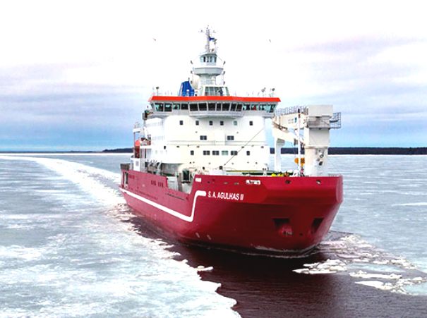
Due to its location at the South Pole, Antarctica receives relatively little solar radiation. This means that it is a very cold continent where water is mostly in the form of ice. Precipitation is low (most of Antarctica is a desert) and almost always in the form of snow, which accumulates and forms a giant ice sheet which covers the land. Parts of this ice sheet form moving glaciers known as ice streams, which flow towards the edges of the continent. Next to the continental shore are many ice shelves. These are floating extensions of outflowing glaciers from the continental ice mass. Offshore, temperatures are also low enough that ice is formed from seawater through most of the year. It is important to understand the various types of Antarctic ice to understand possible effects on sea levels and the implications of global warming.
Sea ice extent expands annually in the Antarctic winter and most of this ice melts in the summer. This ice is formed from the ocean water and floats in the same water and thus does not contribute to rise in sea level. The extent of sea ice around Antarctica has remained roughly constant in recent decades, although the thickness changes are
unclear.
Melting of floating ice shelves (ice that originated on the land) does not in itself contribute much to sea-level rise (since the ice displaces only its own mass of water). However it is the outflow of the ice from the land to form the ice shelf which causes a rise in global sea level. This effect is offset by snow falling back onto the continent. Recent decades have witnessed several dramatic collapses of large ice shelves around the coast of Antarctica, especially along the Antarctic Peninsula. Concerns have been raised that disruption of ice shelves may result in increased glacial outflow from the continental ice
mass.
On the continent itself, the large volume of ice present stores around 70% of the world's fresh
water. This ice sheet is constantly gaining ice from snowfall and losing ice through outflow to the sea. West Antarctica is currently experiencing a net outflow of glacial ice, which will increase global sea level over time. A review of the scientific studies looking at data from 1992 to 2006 suggested that a net loss of around 50 gigatonnes of ice per year was a reasonable estimate (around 0.14 mm of sea level
rise). Significant acceleration of outflow glaciers in the Amundsen Sea Embayment may have more than doubled this figure for
2006.
East Antarctica is a cold region with a ground base above sea level and occupies most of the continent. This area is dominated by small accumulations of snowfall which becomes ice and thus eventually seaward glacial flows. The mass balance of the East Antarctic Ice Sheet as a whole is thought to be slightly positive (lowering sea level) or near to
balance. However, increased ice outflow has been suggested in some
regions.
Effects of global warming
- Warming trend from 1957–2006
Some of Antarctica has been warming up; particularly strong warming has been noted on the Antarctic Peninsula. A study by Eric Steig published in 2009 noted for the first time that the continent-wide average surface temperature trend of Antarctica is slightly positive at >0.05 °C (0.09 °F) per decade from 1957 to 2006. This study also noted that West Antarctica has warmed by more than 0.1 °C (0.2 °F) per decade in the last 50 years, and this warming is strongest in winter and spring. This is partly offset by fall cooling in East
Antarctica. There is evidence from one study that Antarctica is warming as a result of human carbon dioxide
emissions. However, the small amount of surface warming in West Antarctica is not believed to be directly affecting the West Antarctic Ice Sheet's contribution to sea level. Instead the recent increases in glacier outflow are believed to be due to an inflow of warm water from the deep ocean, just off the continental
shelf. The net contribution to sea level from the Antarctic Peninsula is more likely to be a direct result of the much greater atmospheric warming
there.
In 2002 the Antarctic Peninsula's Larsen-B ice shelf
collapsed. Between 28 February and 8 March 2008, about 570 square kilometres (220 sq mi) of ice from the Wilkins Ice Shelf on the southwest part of the peninsula collapsed, putting the remaining 15,000 km2 (5,800 sq mi) of the ice shelf at risk. The ice was being held back by a "thread" of ice about 6 km (4 mi)
wide, prior to its collapse on 5 April 2009. According to NASA, the most widespread Antarctic surface melting of the past 30 years occurred in 2005, when an area of ice comparable in size to California briefly melted and refroze; this may have resulted from temperatures rising to as high as 5 °C (41 °F).
Ozone depletion
Each year a large area of low ozone concentration or "ozone hole" grows over Antarctica. This hole covers almost the whole continent and was at its largest in September 2008, when the longest lasting hole on record remained until the end of
December. The hole was detected by scientists in 1985 and has tended to increase over the years of observation. The ozone hole is attributed to the emission of chlorofluorocarbons or CFCs into the atmosphere, which decompose the ozone into other
gases.
Some scientific studies suggest that ozone depletion may have a dominant role in governing climatic change in Antarctica (and a wider area of the Southern
Hemisphere). Ozone absorbs large amounts of ultraviolet radiation in the stratosphere. Ozone depletion over Antarctica can cause a cooling of around 6 °C in the local stratosphere. This cooling has the effect of intensifying the westerly winds which flow around the continent (the polar vortex) and thus prevents outflow of the cold air near the South Pole. As a result, the continental mass of the East Antarctic ice sheet is held at lower temperatures, and the peripheral areas of Antarctica, especially the Antarctic Peninsula, are subject to higher temperatures, which promote accelerated
melting. Models also suggest that the ozone depletion/enhanced polar vortex effect also accounts for the recent increase in sea-ice just offshore of the continent.
Antarctic meteorite, named ALH84001, from Mars
LINKS
and REFERENCE
-
National
Geophysical Data Center.
National Satellite, Data, and Information Service.
-
Liddell,
Henry George and Scott, Robert (1940). ἀνταρκτικός.
A Greek-English Lexicon. Clarendon Press.
-
https://www.cia.gov/cia/publications/factbook/geos/ay.html#People
-
The
Mariners' Museum. Age
of Exploration: John Cook.
-
U.S.
Antarctic Program External Panel of the National Science Foundation.
Antarctica—Past
and Present.
-
NASA,
U.S. Government Palmer
biography
-
University
of California, San Diego Palmer
Station
-
South-Pole
An
Antarctic Time Line : 1519 - 1959.
-
Polar
Radar for Ice Sheet Measurements. Antarctic
Explorers Timeline: Early 1800s.
-
James
Clark Ross South-Pole -
Exploring Antarctica.
-
Australian
Antarctic Division. Tannatt
William Edgeworth David
-
South-pole
Roald
Amundsen South-Pole - Exploring Antarctica.
-
70South.
Richard
Byrd.
-
U.S.
Navy. Dates
in American Naval History: October.
-
Central
Intelligence Agency Factbook
-
British
Antarctic Survey. Volcanoes.
-
National
Science Foundation. Scientists
Discover Undersea Volcano Off Antarctica.
-
National
Science Foundation Lake
Vostok
-
NASA
Lake
Vostok may teach us about Europa
-
(June
2002) Stonehouse, B. (ed.) Encyclopedia of Antarctica and the
Southern Oceans. John Wiley & Sons. ISBN 0-471-98665-8.
-
(September
2002) Trewby, Mary (ed.) Antarctica: An Encyclopedia from Abbott
Ice Shelf to Zooplankton. Firefly Books. ISBN 1-55297-590-8.
-
British
Antarctic Survey. Weather
in the Antarctic
-
R.K.
Headland, The Island of South Georgia, Cambridge University Press,
1984.
-
The
Antarctic Sun Questions
and answers
-
Australian
Antarctic Division Antarctic
Wildlife
-
Creatures
of Antarctica
-
BBC
News. Toothfish
at risk from illegal catches.
-
Australian
Antarctic Division. Toothfish.
-
Scientific
Committee on Antarctic Research. Antarctic
Treaty
-
Antarctica
Institute of Argentina. Argentina
in Antarctica
-
U.S.
Navy Antarctic
Service Medal
-
United
States CIA
World Factbook
-
International
association of Antarctica Tour Operators. Tourism
Statistics.
-
Politics
of Antarctica
-
Telegraph
UK. Tourism
threatens Antarctic.
-
Antarctic
Connection Science
in Antarctica
-
NASA
Meteorites
from Antarctica
-
Gorder,
Pam Frost (June 1, 2006). Big
Bang in Antarctica -- Killer Crater Found Under Ice. Research
News.
Solar
Cola drinkers care about planet
earth
..
Thirst for Life

(330ml
Planet
Earth can)
|
Adelaide
Aden
- Yemen
Afghanistan
Africa
Alaska
Albania
Algeria
Amazon
Rainforest
Amsterdam
Antarctic
Arctic
North Pole
Argentina
Asia
Athens
Atlantis
- Plato's Lost City
Australia
Austria
Aztecs
- Mexico
Baghdad
Bahamas
Bahrain
Bangladesh
Barbados
Beachy
Head, England
Belgium
Benin
Berlin
Bermuda
Black
Rock Desert
Bohemia
Bolivia Bonneville
Utah History
Bonneville,
Utah, USA
Brazil
Brighton
- West Pier
British
Columbia
Buckingham
Palace
Bulgaria
Burkina
Faso
Burma
California
Canada
Canary
Islands
Cape
Horn
Cape
Verde
Cape
York - Au
Caribbean
Cayman
Islands
Central
Africa
Chichester
Harbour
Chile
China
Columbo
- Sri Lanka
Columbia
Corfu
Cowes,
Isle of Wight
Croatia
Crooked
Island, Bahamas
Cuba
Cyprus
Czechoslovakia
Darwin
- Australia
Daytona
Beach
Denmark
Eastbounre
Pier, England
Earthquakes
Ecuador
Egypt
Eindhoven Estonia
Equator
Europe
Falkland
Islands
Falmouth,
Cornwall
Fiji
Finland
France
Galapagos
Islands
Geography
Links
Geography
Mountains
Geography
Records
Geography
Resources
Geography
Statistics
|
Germany
Ghana
Gibraltar
- Links
Greece
Greenland
Guinea
Guinea
Bissau
Hawaii
Holland
the Nertherlands
Hollywood,
California, LA
Hong
Kong
Hungary
Hurricanes
Iceland
India
Indonesia
Links
Iran
Iraq
Ireland
Isle
of Man
Isle
of Wight
- The
Needles
Israel
Italy
Ivory
Coast
Jakarta
- Java
Japan
Johannesburg
Jordan
Kent,
England
Kenya
Korea
Kuwait
Kyoto
Lanzarote,
Gran Canaria
Las
Vegas
Lebanon
Liberia
Libya
Liechtenstein
Life
on Earth
Lithuania
London
- Big
Ben
London
Eye
London
Houses
Parliament
London
- Buckingham
Palace
London
- Old
Bailey
London
- Overview
London
- The City
London
- Tower Bridge
London
- Trafalgar
Square
Luxembourg
Madame
Tussauds
Malaysia
Mali
Malta
Marshal
Islands
Mauritania
Maya
Empire -
Central America
Melbourne,
Australia
Middle
East
Melbourne,
Australia
Mexico
Monaco
Morocco
Mountains
Mumbai
Naples-
Italy
National
Geographic
Nepal
New
York
New
Zealand
Niger
Nigeria
North
Africa
Norway
Nova
Scotia
Oceans
and Seas
Oman
Pakistan
Palermo
- Sicily
Palestine
Palma
- Malorca
|
Panama
Canal - Links
Paris
Pendine
Sands
Peru
Philippines
Pisa,
Leaning Tower
Planet
Earth
Poland
Port
Moresby - PNG
Port
Said - Egypt
Portugal
Puerto
Rico
Qatar
Quebec
Rio
de Janeiro
Romania
Rome
Russia
Salt
Lake City
Samoa
Saudi
Arabia
Scandanavia
Scotland
Senegal
Siera
Leone
Singapore
Solomon
Islands
Somalia
South
Africa
South
America
Southampton
Spain
- Espana
Sri
Lanka - Links
Stonehenge
Sudan
Suez
Canal
Sundancer
Holiday Resort
Sussex,
England Index
Sweden
Switzerland
Sydney,
Australia
Syria
Tahiti
- Polynesia
- Links
Tahitian
- Men & Women Customs
Taiwan
Thailand
The
Gambia
Togo
Tokyo,
Japan
Tonga
- Polynesia
Toronto
Trinidad
- Lesser Antilles
Trinidad
and Tobago
Tsunami
Tunbridge
Wells, England
Tunisia
Turkey
Tuvalu
Islands
UAE
- United Arab Emirates
UK
Statistics
Ukraine
United
Kingdom
United
Kingdom -
Gov
USA
Uruguay
Vanuatu
Islands
Vatican
City
Venezuela
Venice
Vienna
Vietnam
Volcanoes
Volendam
Wales
Washington
D.C.
WAYN
Where Are You Now
Wealden
iron industry
Wendover
West
Africa
World
Peace Supporters
Yemen
Yugoslavia
Zurich
|
A
heartwarming adventure: Pirate whalers V Conservationists,
with
an environmental message.