|
TAHITI - FRENCH POLYNESIA
|
|||||||||||||||||||||||||||||||||||||||||||||||||||||||||||||||||||||||||||||||||||||||||||||||||||||||||||||||||||||||||||||||||||||||||||||||||||||||||||||||||||||||||||||||||||||||||||||||||||||||||||||||||||
|
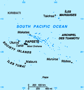
Tahiti is the largest island of French Polynesia, located in the archipelago of Society Islands in the southern Pacific Ocean at . The island had a population of 169,677 inhabitants according to the 2002 census. (This makes it the most populated island of French Polynesia holding 69% of the total population.) The capital is Papeete, on the northwest coast. Tahiti has also been historically known as Otaheite.
Tahiti triangle - Pacific Ocean
Geography
Tahiti is some 45 km (28 mi) long at the widest point and covers 1,048 km² (404 sq mi), with the highest elevation being at 2,241 m (7,352 ft) above sea level (Mount Orohena). The island consists of two roughly round portions centered on volcanic mountains, connected by a short isthmus named after the small town of Taravao, which sits there. The northwestern part is known as Tahiti Nui ("big Tahiti"), and the southeastern part, much smaller, is known as Tahiti Iti ("small Tahiti") or Taiarapu. Whereas Tahiti Nui is quite heavily populated (especially around Papeete) and benefits from rather good infrastructure such as roads and highways, Tahiti Iti has remained quite isolated, its southeastern half (Te Pari) being accessible only by boat or hiking. A main road winds around the island between the mountains and the sea while an interior road climbs past dairy farms and citrus groves with panoramic views
Map of Tahiti - South Pacific Ocean
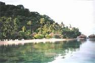
The vegetation is tremendously lush rain forest.
Some references have mistakenly labeled November through April as Tahiti's wet season. But, according to a 2001 UCLA research study done using years of government cataloged weather data, the islands of Tahiti receive, on average, more hours of sun, and less hours of rain, than Hawaii does year round. Graphs demonstrating the results of the study can be found at Tahiti Tourisme North America's website (the official government sanctioned site for the destination).
HistoryTahiti was estimated to have settled by Polynesians between AD 300 and 800 coming from Tonga and Samoa, although some estimates place the date earlier. The fertile island soil combined with fishing provided ample food for the population.
Although the first European sighting of the islands was by a Spanish ship in 1606, Spain made no effort to trade with or colonize the island. Samuel Wallis, an English sea captain, sighted Tahiti on June 18, 1767, and is considered the first European visitor to the island. The perceived relaxed and contented nature of the local people and the characterization of the island as a paradise much impressed early European visitors, planting the seed for a romanticization by the West that endures to this day.
Wallis was followed in April 1768 by the French explorer Louis-Antoine de Bougainville who was completing the first French circumnavigation. Bougainville made Tahiti famous in Europe when he published the account of his travel in Voyage autour du Monde. He described the island as an earthly paradise where men and women live happily in innocence, away from the corruption of civilization. His account of the island powerfully illustrated the concept of the noble savage, and influenced the utopian thoughts of philosophers such as Jean-Jacques Rousseau before the advent of the French Revolution.
In 1774 Captain James Cook visited the island, and estimated the population at that time to be some 200,000. This was probably too high; another estimate from the same period was 121,500. After Cook's visit, European ships landed on the island with ever greater frequency. The best-known of these ships was HMS Bounty, whose crew mutinied shortly after leaving Tahiti in 1789. The European influence caused significant disruption to the traditional society, by bringing prostitution, venereal diseases, and alcohol to the island. Introduced diseases including typhus and smallpox killed so many Tahitians that by 1797, the island's population was only about 16,000. Later it was to drop as low as 6,000.
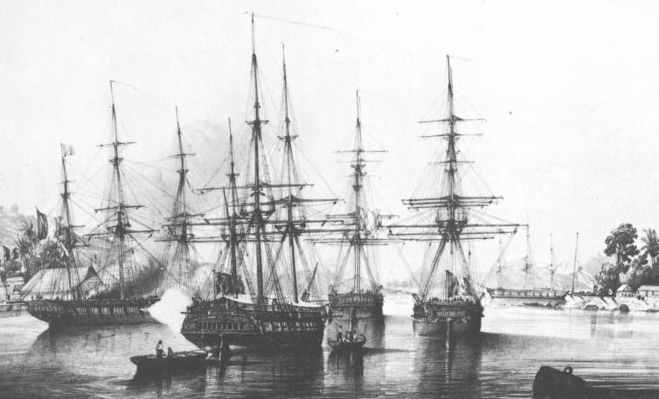
Dupetit Thouars taking over Tahiti on September 9th, 1842
In 1842, a European crisis involving Morocco escalated between France and Great Britain when Admiral Dupetit Thouars, acting independently of the French government, was able to convince Tahiti's Queen Pomare IV to accept a French protectorate. George Pritchard, a Birmingham-born missionary and acting British Consul, had been away at the time of the agreement. However he returned to work towards indoctrinating the locals against the Roman Catholic French. In November 1843, Dupetit-Thouars (again completely on his own initiative) landed sailors on the island, formally annexing it to France. He then proceeded to throw Pritchard into prison, subsequently sending him unceremoniously back to Britain.
News of the events in Tahiti reached Europe in early 1844. The French statesman François Guizot, supported by King Louis-Philippe of France, had strongly denounced the annexation of the island. However, war between the French and the Tahitians continued until 1847. The island remained a French protectorate until June 29, 1880, when King Pomare V (1842–1891) was forced to cede the sovereignty of Tahiti and its dependencies to France. He was given the titular position of Officer of the Orders of the Legion of Honour and Agricultural Merit of France. In 1946, Tahiti and the whole of French Polynesia became a Territoire d'outre-mer (French overseas territory). In 2003, this status was changed to that of Collectivité d'outre-mer (French overseas community).
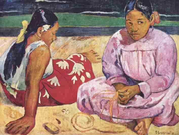
French painter Paul Gauguin lived on Tahiti in the 1890s and painted many Tahitian subjects. Papeari has a small Gauguin museum.
Politics
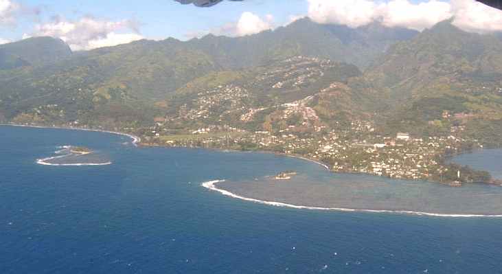
Aerial view of Arue and Mahina area, east of Papeete
Tahitians are French citizens with full civil and political rights. The Tahitian language and the French language are both in use.
Tahiti is part of French Polynesia (Polynesie Française). French Polynesia is now a semi-autonomous territory of France with its own assembly, President, budget and laws. France's influence is limited to providing subsidies, education and security. The current President of French Polynesia, Oscar Temaru, is advocating full independence from France, however, only about 20% of the population is currently in favor of full independence.
During a press conference on June 26, 2006 during the second France-Oceania Summit, French President Jacques Chirac said he did not think the majority of Tahitians wanted independence. He said he would keep an open door to a possible referendum in the future.
Elections for the Assembly of French Polynesia, the Territorial Assembly of French Polynesia, were held on May 23, 2004. In a surprise result, Oscar Temaru's pro-independence progressive coalition formed a Government with a one seat majority in the 57 seat parliament, defeating the conservative party led by Gaston Flosse. On October 8, 2004, the Gaston Flosse led opposition party succeeded in passing a censure motion against the Government, provoking a political crisis. A major topic of controversy is whether the national government of France should use its exceptional power to call for new elections in a local government, in case of a grave political crisis.
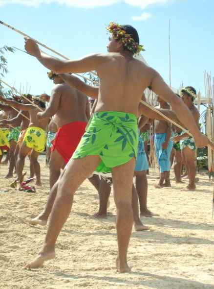
Javelin throwing at the Heiva annual cultural festival in Papeete
Economy
Tourism is a significant industry, mostly to the islands of Bora Bora and Moorea. In July, the Heiva festival in Papeete celebrates Polynesian culture and the commemoration of the storming of the Bastille in France.
After the establishment of the CEP (Centre d'Experimentation du Pacifique) in 1963, the standard of living in French Polynesia increased considerably and as a result, many Polynesians abandoned traditional activities and many islanders decided to emigrate to the centre at Papeete. Even though the standard of living in Polynesia is elevated (due mainly to France's FDI investment), the economy is extremely reliant on imports. At the cessation of CEP activities, France signed the Progress Pact with Tahiti to compensate the loss of financial resources and assist in education and tourism with an investment of about US$150 Million a year from the beginning of 2006. The main trading partners with Tahiti are France which accounts for about 40% of imports and about 25% of exports, the USA, Japan, Australia and New-Zealand.
Black pearl farming is also a substantial source of revenues, most of the pearls being exported to Japan, Europe and the US. Tahiti also exports vanilla, fruits, flowers, monoi, fish, coprah oil, and noni.
Unemployment affects about 13% of the active population, especially women and unqualified young people.
French Pacific Franc
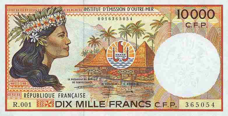
Tahiti’s currency, the French Pacific Franc (CFP), is on parity with the French Franc (about 100 CFP’s for every U.S. dollar). Hotels and financial institutions offer exchange services. U.S. currency and major credit cards are widely accepted.
There is no sales tax in Tahiti. However, a special 2% reduced rate Value Added Tax (VAT) applies to all rented accommodations (hotel rooms, pensions and family stays), and room and meal packages for tourists. A 4% VAT rate applies to purchases in shops, stores and boutiques. A 6% VAT rate applies to bars, excursions, car rentals, snacks and restaurants.
Education
Tahiti hosts a French university, Université de la Polynésie Française ("University of French Polynesia"). It is a small growing university, with around 2,000 students and about 60 researchers. Le Collège La Mennais is located in Papeete.
Arts and music
Recently there has been a strong push to revive old ways and rediscover traditional arts. Traditional musical instruments include pahu and toere drums and the curious nose flute called a vivo. Guitars and ukuleles made their way into Polynesia and the locals developed a unique song style that owes much to country & western music in form but has a distinctive South Pacific island groove. Customary dancing (tamure) has slowly made its way back into French Polynesian life, but the art of making tapa (bark paper and cloth) has largely disappeared.
Transport
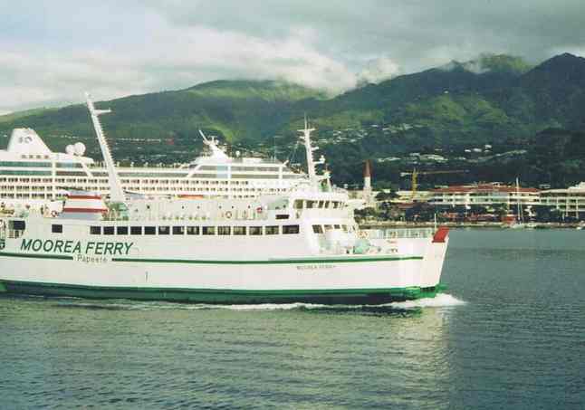
Moorea ferry
Faa'a International Airport is the international airport of Tahiti with Air Tahiti the national airline. The Moorea Ferry is also a notable ferry that operates from Papeete.
Tahiti is just one of a group of closely situated Islands in the South Pacific Ocean bearing different names and identities. With a peak of 1042 km2, Tahiti is the largest of the Polynesian islands. Even Tahiti is really composed of 2 islands: Tahiti-Nui, the big island and Tahiti-Iti, the small one, both linked by an isthm. Tahiti's highest mountains are: the Orohena (2235 m) and the Aorai (2066 m). The Tahitian population is also the most concentrated especially in Papeete, the capital city and gateway of the territory. Papeete boasts bustling markets, fine restaurants, pearl shops, clubs and boutiques.
TAHITI - The Gathering Place
Tahiti-Nui & Tahiti-Iti Islands
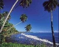
The public transport system, called: Le Truck, provides an interesting way of seeing the local towns and people. A taxi service is also available from your hotel to restaurants and shopping and is best arranged by your hotel concierge. Car rentals are also available from the airport and your hotel. Helicopters can be hired for dramatic island tours or for transportation to Moorea and Bora Bora. You will find beautiful white sand beaches between the districts of Punaauia and Papara. The black sand beach of the Pointe Vénus is the most famous of the black sand beaches located on the East coast of Tahiti. The interior of the island offers splendid and unforgettable opportunities for hiking or safari 4x4 excursions, with impressive waterfalls, archeological sites, grottoes, etc...
To visit:the Papeete Public Market; the new To'ata Square open 24hrs a day ideal for strolling and also serves as a showground for the Heiva Festival; the art galleries in Papeete and in the districts of Papara and Afaahiti; the museums; the churches like the Cathedrale of Papeete; the Botanical Garden in Papeari and the Mataoa Gardens in Papara; the different town halls like in Papeete, Arue, Faaa; the Chinese Temple in Mamao, the lagoonarium in Punaauia, the historical Pointe Vénus lighthouse; the tomb of the royal family Pomare in Arue; the marae Arahurahu; the lake Vaihiria with its eels that have ears; the different valleys and mountains of Tahiti like the Aorai, the Mont Marau; the 3 cascades (waterfalls) of Tiarei; the lavatubes of Hitiaa; and of course the peninsula and the cliffs of the "Pari", paradise for hikers looking for adventure... Do not hesitate to circle the island. In Taravao, you can reach the peninsula of Tahiti Iti by crossing the small isthm.
Papenoo beach
Festivals & Events:
HUAHINE - Garden of Eden
Huahine Tiare Beach
With
its lush forests and untamed landscape, Huahine is Polynesia's
best kept secret. A deep crystal-clear lagoon surrounds the
two islands while magnificent bays and white-sand beaches add
drama and solitude to their virtues. Huahine's few
residents are warm, welcoming visitors with great
kindness. With its rich and fertile soil, the island
provides farmers bountiful harvests of vanilla, melons and
bananas.
Tahitian Women on the Beach 1891 painting by Paul Gauguin
Do not miss visiting the interior of the island, the Maeva marae at the foot of Mount Mouatapu and on the shores of lake Fauna Nui; the Belvedere for a beautiful view of Maroe Bay; the vanilla plantations; the Eden Parc -an 8-acre botanical garden and the awesome surfing spots !
Festivals & Events:
Located at only 40 km from Bora Bora, Maupiti is a small island with a superficy of a little less than 20 km2 that you can circle by foot or by bicycle in about half a day. With only 1 difficult pass, the access by sea of this island is limited. From the airport (located on a motu) to your pension, you will take a boat trip and have the opportunity to admire the beautiful lagoon and its fish, rays and corals.
|
|
LEG |
NAUTICAL MILES |
BUNKERING |
WAYPOINT |
SUNSHINE DAYS |
|
- |
- |
- |
- |
- |
|
|
- |
- |
- |
- |
|
- |
- |
FILL UP |
00.00 |
|
|
1 |
729 |
- |
1.90 |
|
|
2 |
3,154 |
- |
8.21 |
|
|
3 |
1,182 |
1 |
3.00 |
|
|
4 |
970 |
- |
2.45 |
|
|
5 |
3,640 |
- |
9.48 |
|
|
6 |
1,423 |
- |
3.71 |
|
|
7 |
410 |
- |
1.07 |
|
|
8 |
1,886 |
1 |
4.91 |
|
|
9 |
340 |
- |
0.88 |
|
|
10 |
724 |
- |
1.89 |
|
|
11 |
1,572 |
- |
4.09 |
|
|
12 |
1,881 |
- |
4.90 |
|
|
13 |
2,109 |
1 |
5.49 |
|
|
14 |
698 |
- |
1.82 |
|
|
15 |
670 |
- |
1.75 |
|
|
16 |
1,111 |
- |
2.89 |
|
|
17 |
170 |
- |
0.44 |
|
|
18 |
940 |
|
2.45 |
|
|
- |
- |
- |
- |
- |
|
- |
23,609 |
- |
RUNTIME DAYS @ 12.5kts |
78.70 |
|
- |
- |
(ADD 3 DAYS) |
RUNTIME DAYS @ 13kts |
75.67 |
|
- |
- |
- |
- |
- |
|
- |
- |
(ADD 4 DAYS) |
14 KNOTS AVE INC |
70.26 |
|
- |
- |
- |
AT 15 KNOTS AVE |
65.58 |
|
- |
- |
- |
AT 16 KNOTS AVE |
61.48 |
|
1. |
|
|
|
2. |
DAY 14 UPDATE |
|
|
3. |
DAY 28 UPDATE |
|
|
4. |
DAY 42 UPDATE |
|
|
5. |
DAY 56 UPDATE |
|
|
6. |
DAY 70 UPDATE |
|
|
7. |
DAY 84 UPDATE |
|
|
8. |
DAY 98 LATEST |
|
|
9. |
DAY 112 UPDATE |
|
|
10. |
DAY 126 UPDATE |
|
|
11. |
DAY 140 UPDATE |
|
|
12. |
DAY 154 UPDATE |
|
|
13. |
DAY 168 UPDATE |
|
|
14. |
DAY 182 UPDATE |
|
|
15. |
DAY 196 LATEST |
|
|
16. |
DAY 210 UPDATE |
|
|
17. |
DAY 224 UPDATE |
|
|
18. |
DAY 238 UPDATE |
|
|
19. |
DAY 252 UPDATE |
|
|
20. |
DAY 266 UPDATE |
|
|
- |
|
HOMECOMING |
Festivals & Events:
February: Tahiti Marathon September:
Super Aito Canoe Race October:
Aitoman Triathlon
BORA
BORA - The
Romantic Island
Bora pearl beach
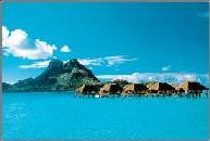
At a distance of 260km from Tahiti, these 40 km2 of superficy were once paradise for the US Navy in the Pacific during World War II. Bora Bora, whose ancient name is Pora Pora (since the letter B does not exist in the Tahitian language), is recognizable by the flat profile of her mountain Otemanu (727 m) and above all known for the beauty of her turquoise waters.
Bora Bora is served by Air Tahiti with regular 35-minute flights from Papeete and Moorea, and 20-minute flights from Huahine and Raiatea. The airport is based on one of her motus: Motu Mute, and is only accessible to the hotels by a passenger ferry to the port village of Vaitape or by private motorboats operated by some of the hotels. Bora Bora has a few taxis and operates the public transit system, Le Truck. The picturesque circle-island and interior roads are best explored through hired excursion. Car and bicycle rentals are available, while motorboat and outrigger canoe rentals offer an enjoyable way to discover the lagoon and surrounding motus. Helicopters can also be hired for dramatic island tours or transportation to Papeete.
To visit: the motus especially Motu Tapu; the raised stones of the royal Farerua marae also called Marotetini; the former US naval base; the summit of Mt Pahia for its breathtaking view...

Festivals
& Events:
February: Tahiti International Billfishing Tournament August: Island Heiva Celebration October: Finish of the Hawaiki Nui Va'a Canoe Race with huge island celebration.(Race best described as the "Super Bowl" of canoe races. It is the world's largest and longest international open-ocean canoe race and covers a grueling 72 miles between Huahine and Bora Bora.)
Raiatea
- The
Sacred Island
& Tahaa
- The
Vanilla Island
Located 220 km North West of Tahiti, Raiatea is the largest and the administrative center of the Leeward Islands (Iles Sous Le Vent) with a superficy of 200 km2.
She shares her lagoon with the neighbor island of Tahaa
(88km2), at a distance of only
5 km.
Raiatea is served by Air Tahiti with frequent 40-minute flights from Papeete and Moorea, and with several daily 15-minute flights from Huahine and Bora Bora. Tahaa is served only by water taxi from Raiatea.
Both Raiatea and Tahaa have a few taxis, and Raiatea operates
the public transit system, Le Truck, with daily routes from
outlying villages to the town of Uturoa.
In the past named Havaii or Havaiki, original land of the Maohi and the center of religion and culture around 1000 years ago, Raiatea is a sacred island and she proves it by the number of her marae including the largest in Polynesia and the most famous one of Taputapuatea, held sacred to the god of war, Oro.
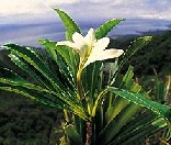
On the mount Temehani (772m), and nowhere else in the world (it resists transplantation), grows a unique and protected flower: the Tiare Apetahi, white flower with four petals, bigger and more open than the ones of the Tiare Tahiti, and that only opens at dawn with a slight crackling sound. Many locals sleep overnight on the mountain to be able to hear that sound.
Tiare Apetahi
Raiatea also has the deepest bay in Polynesia: the bay of Faaroa. Winding through a lush rainforest, the Faaroa River is the only navigable river in Polynesia. Its historic shores launched migratory journeys to faraway islands now called Hawaii and New Zealand.
To visit: the "bassin de la Reine";
the marae Taputapuatea, the Belvedere on Mt. Tapioi (294m),
the Mt. Temehani with its tiare apetahi, the site Te Puhapa,
the vanilla plantations.
Tahaa is an enjoyable island to explore at a slower pace. The coral reef surrounding the flower-shaped island is crowned with as many as 60 tiny, idyllic motus perched above the North shore. A road that is nearly 70 kms in length circles the coastal plain. Along the way, eight attractive and tranquil villages are dotted, with Patio being the main one.
Much of Tahiti's harvest of vanilla is grown on this small
island. Plantation tours include strolling among the rows of
climbing orchids from which the vanilla pods come and a
demonstration of the pollination and curing process.
To visit: the Foundation Hibiscus for the protection of sea turtles, the pearl farms, the vanilla plantations.
Festivals & Events:
November: Stone Fishing Tournament. In the method of
their ancestors, men in dozens of canoes beat the water with
stones tied to ropes while the schools of fish are driven
ashore where they are easily collected for an extravagant
feast.
Tetiaroa Beach
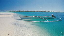
Located at only 44 km North of Tahiti, Tetiaroa is most visible from the hills of the district of Mahina. This atoll is composed of 13 motu" (islets) with white sand beaches and coconut trees, all surrounded by a limpid lagoon delimited by a coral reef barrier. This lagoon of 7km in diameter, 55 km in circumference and 30 meters in depth is very difficult to access especially with only one small canoe pass. Therefore, this atoll is mainly accessible by plane. Out of all the motus which rarely go over 3 meters in altitude, only the main motu (motu Onetahi) where the Tetiaroa Village is located is inhabited.
This atoll, administered by the district of Arue, is, since
1965, the property of Marlon Brando who fell in love with
these islets when filming the Mutiny of the Bounty. Marlon
Brando built there a small landing strip and a small (and the
only) hotel called Tetiaroa Village. He opened his atoll to
the public in 1972. Most
visits are between 1 and 3 days MAXIMUM and can be arranged
from either Tahiti or Moorea. Longer term" stays
require special permission from the owners. If
you do not have time to visit the Tuamotus, we recommend
visiting Tetiaroa because of its proximity to Tahiti and its
similarity with the Tuamotu atolls.
To visit with care: The Bird Island of Tahuna Iti, favored by the red-breasted black frigate birds, the phaetons or "straw tails", brown gannets and other petrels for breeding purposes.
About 200 miles North East of Tahiti lies the
Tuamotu Archipelago, composed of the largest collection of
coral atolls in the world. The Tuamotu count 78 atolls
spread unevenly on 1,500km of land and 20,000 km2 of
ocean. The waters of the Tuamotus are a scuba diver’s
dream. Whether you opt for shallow, ocean or drift dives, the
underwater scenery is guaranteed to be some of the most
spectacular you’ve ever seen.
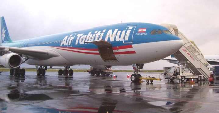
Among the most known atolls, Rangiroa, Manihi and the atolls of Tikehau and Fakarava are served from Papeete by Air Tahiti with several daily one-hour flights to Rangiroa, with continuing service of 35 minutes to Manihi.
Air Tahiti also operates several weekly flights from Bora Bora
to Rangiroa and Manihi.
With only a few miles of road, there is little need for public
transportation. To explore the islands, rent open-air cars or
bicycles. To explore the lagoon and surrounding motus, rent a
motorboat, canoe or sailboat.
Located 350 km
North East of Tahiti and mostly called by the Tahitians "Rairoa"
(Long sky), Rangiroa is the largest atoll of Polynesia or more
accurately the largest lagoon of Polynesia (since the island
of Tahiti could fit in it!) with a superficy of about 1000 km2
and more than 240 motus.
Rangiroa is a string of coral encircling a luminous
turquoise and jade-green lagoon and, with its waters with
150-foot visibility, is a paradise for divers and snorkelers!
In Rangiroa, to "shoot the pass" is to experience what many have called "the world's greatest adrenaline rush!". Divers, snorkelers, or those aboard a glass-bottom boat are carried swiftly through the pass between the open ocean and lagoon alongside an infinite array of marine life (squadrons of eagle rays, schools of sharks, tuna, jacks and barracuda,...)
To visit: Gauguin's Farm Pearl in Avatoru, Some of the world's best diving sites, the Reef Passe
Like a round swimming pool, the atoll of Tikehau and its diameter of 26 km holds an interior lagoon with the most fish compared to the rest of the atolls in Polynesia. This atoll is located 300km Northwest of Tahiti and about 12 km from Rangiroa.
Tikehau has a large pass and a series of islets, the largest
of which at the Southwest of the atoll, 900meters wide is
inhabited.
The charming village of Tuherahera, swathed in flowers, is
situated on the South end of this large motu which also has
two other villages: Tuheiava, an important center for lagoon
fishing and the many fish parks that supply the markets of
Tahiti; and Maiaia on the Northeast that is a traditional
copra producer.
Scuba diving in the Tuheiava Pass is a must: the manta rays'
dance alternates with the parades of schools of barracuda, and
tuna fish, not to mention the gray and the white-tipped
sharks.
Air Tahiti
LINKS and REFERENCE
Official Website (Tahiti Tourism Board)
Picture of Bora Bora and Vahine100's of Images
University of French Polynesia
Satellite view of Tahiti and Moorea
Photogallery of Society Islands
Faufa'a Tupuna, le wiki consacré au patrimoine culturel polynésien
Cook's Pacific Encounters: Cook-Forster Collection online Images and descriptions of more than 300 artefacts collected during the three Pacific voyages of James Cook, including nearly 100 objects from Tahiti and the Society Islands.
|
Atlantis - Plato's Lost City
|
Isle of Wight - The Needles Korea South Republic Korea North London - Big Ben London Houses Parliament London - Buckingham Palace London - Old Bailey London - Trafalgar Square Maya Empire - Central America
|
Sri Lanka - Links Tahitian - Men & Women Customs UAE - United Arab Emirates United Kingdom - Gov
|
Solar Cola drinkers care about planet earth
.. Thirst for Life
(330ml Planet Earth can)
Solar Red | Solar Crush | Solar Cola | Solar Spice | Solar +
This website is Copyright © 1999 & 2024 Cleaner Ocean Foundation. COF is an educational charity.

